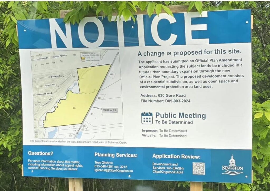
What’s Happening?
Official Plan Amendment & Rezoning Request
The property at 630 Gore Road is currently designated primarily as a Rural and Environmental Protection Area under Kingston’s Official Plan. These designations protect the area’s natural features and limit large-scale development.
However, the property owner has submitted an application requesting an Official Plan Amendment and rezoning to change the land’s use. This would allow the development of a residential subdivision consisting of single and semi-detached homes.
This rezoning request is tied to a proposal to expand Kingston’s urban boundary to include this rural land within the city’s urban area, which would be a significant change in how this land is managed and developed.
The City of Kingston is actively reviewing this application as part of the broader Official Plan Project. While no public meetings have occurred yet, a Community Meeting is anticipated this fall, offering residents an important opportunity to provide input on this and other urban boundary expansion proposals.
Understanding this rezoning process is key to following the future of our neighborhood’s green space and habitat. Staying informed and involved will help ensure community voices are heard throughout this critical planning phase.
Historical Background
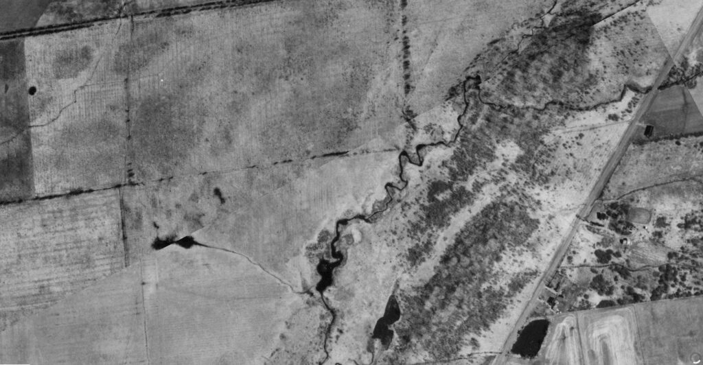
Photo credit: City of Kingston, KMaps, 1984 Air Photo Service
There is some misconception that the west side of Butternut Creek was once densely forested. However, archival photos from the 1980s clearly show that much of this land was historically used as farmland, while the east side of Butternut Creek remained forested. Understanding this history is important – it highlights how the land has evolved and provides context for ongoing discussions about conservation, development, and ecological value.
Recent Developer Activity and City Response
In late April 2025, the developer’s operator began clearing parts of the 630 Gore Road property, relying on provincial soil re-use regulation O.Reg. 406/19. This land includes segments of Butternut Creek.
The clearing resulted in:
- Loss of several acres of wildlife habitat and vegetation, including trees smaller than 15 cm diameter at breast height.
- Concerns over transparency, consultation processes, and environmental impacts.
- Strong opposition and mobilization from residents and environmental groups alarmed by the potential harm to Butternut Creek’s natural heritage.
In response, the City of Kingston issued a Stop Work Order in late May 2025 to halt all clearing activities until proper permits are obtained and reviewed.
In June 2025, the City’s Director of Planning Services refused the Tree Permit application submitted for the site, meaning no tree removal is currently authorized. The developer may appeal this decision to City Council within 30 days, at which point the Council will review the refusal and make a final determination.
The Stop Work Order remains in effect until further notice, preventing further clearing or tree removal.
Thanks to ongoing community vigilance – including resident documentation and advocacy – the city continues to monitor the situation closely.